


IPY 2007-2008

Home » Maps
A selection of maps of areas of work
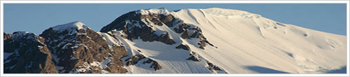


Camp in Fleming Glacier
The red triangle indicates the position of the Automatic Weather Station, blue circles show the location of radar and GPS data. Background: Radarsat mosaic of 1997(Jezek & RAMP Product Team, 2002).
The red triangle indicates the position of the Automatic Weather Station, blue circles show the location of radar and GPS data. Background: Radarsat mosaic of 1997(Jezek & RAMP Product Team, 2002).

CAMS Flights
Reconnaissance flight employing the CECS Airborne Mapping System, CAMS. In total, 550 km of elevation data and aerial fotos were collected (Radarsat mosaic of 1997).
Reconnaissance flight employing the CECS Airborne Mapping System, CAMS. In total, 550 km of elevation data and aerial fotos were collected (Radarsat mosaic of 1997).

Fleming Glacier Antarctic Peninsula
This map represents data acquired during the Ring Project "Stability and recent behaviour of glaciers in the Antarctic Peninsula: Interactions with ice shelves" conduced by Centro de Estudios Científicos, Valdivia, Chile in years 2007 to 2010. Activities include field instrumentation with Automatic Weather Station (AWS) and continuous GPS, airborne laser survey with the own designed CECS Airborne Mapping System (CAMS) and remote sensing analysis and mapping of ice-shelf frontal variations. Main results are published in Wendt et al. : Recent ice elevation changes of Fleming Glacier in response to the removal of Wordie ice shelf, Antarctic Peninsula, Annals of Glaciology, 55.
This map represents data acquired during the Ring Project "Stability and recent behaviour of glaciers in the Antarctic Peninsula: Interactions with ice shelves" conduced by Centro de Estudios Científicos, Valdivia, Chile in years 2007 to 2010. Activities include field instrumentation with Automatic Weather Station (AWS) and continuous GPS, airborne laser survey with the own designed CECS Airborne Mapping System (CAMS) and remote sensing analysis and mapping of ice-shelf frontal variations. Main results are published in Wendt et al. : Recent ice elevation changes of Fleming Glacier in response to the removal of Wordie ice shelf, Antarctic Peninsula, Annals of Glaciology, 55.
Last News
Larsen C 2010 field season
16-11-2010
This year we will be returning to the Larsen C Ice Shelf to continue research on the US NSF ...

II International Symposium - P...
04-05-2010
This new meeting looks for enhancing the interactions between scientists working in quantita...
SCAR Buenos Aires
05-04-2010
The Open Science Conference meeting of the Scientific Comittee of Antarctic Research (SCAR) is held this time in the city of Bu...